On 5 August 2015 the Animas Turned Orange
An EPA contractor's breach of the Gold King Mine sent three million gallons of acid mine drainage into the Animas River — and the plume reached the San Juan before the week was out.
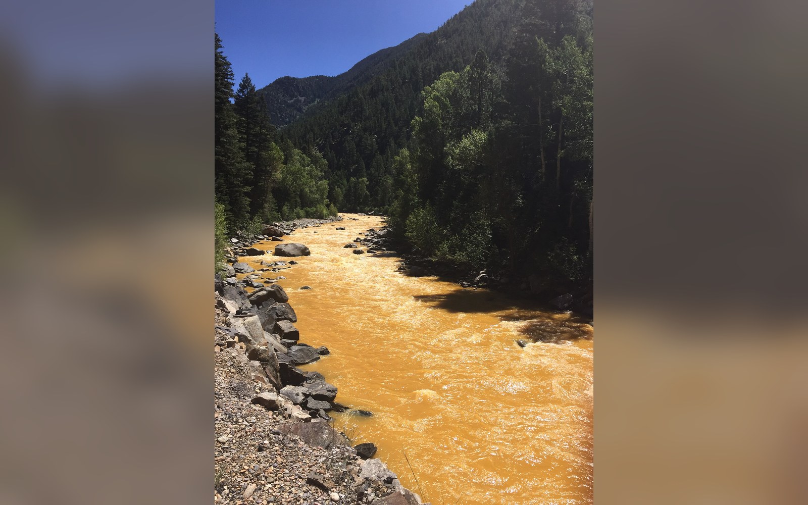
What the Contractor Opened
At approximately 10:30 in the morning on 5 August 2015, workers contracted by the U.S. Environmental Protection Agency were probing the portal of the Gold King Mine, a long-idled silver and gold prospect located above Silverton in the upper Cement Creek drainage, roughly fifteen hundred feet above the town. Their immediate task was to assess conditions inside the mine and evaluate options for treating the contaminated water that had been pooling, under considerable hydraulic pressure, behind a plug of debris and collapsed material at the portal entrance. When the excavator breached that plug, the accumulated water erupted outward in a surge the EPA later estimated at approximately three million gallons.
The water was not merely acidic. The EPA's own incident report documented a metals load that included iron, aluminum, manganese, zinc, lead, arsenic, cadmium, and copper — each in concentrations that varied by compound but collectively rendered the initial plume visibly ochre-orange, the color caused by precipitated iron hydroxides suspended in the flow. Iron concentrations in the immediate discharge ran into the thousands of parts per billion. Arsenic and lead, both acutely toxic at far lower thresholds, were measured at levels well above EPA drinking-water standards in samples taken from Cement Creek within hours of the breach.
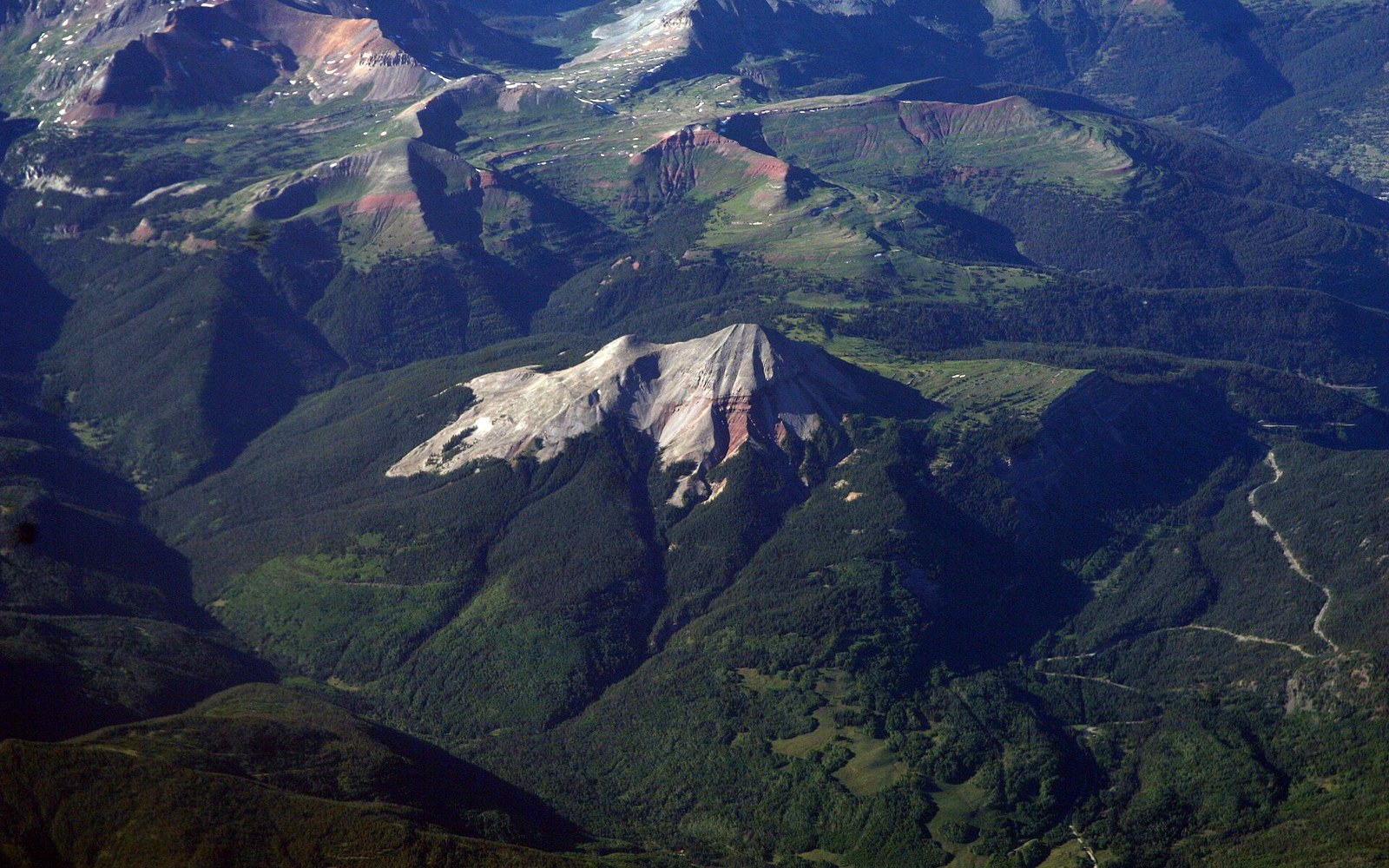
The Gold King was not an isolated case. It sat inside the Bonita Peak Mining District, a cluster of more than forty historic mine workings that had been leaking acid mine drainage — water contaminated by sulfuric acid and dissolved heavy metals produced when air and water react with sulfide minerals exposed by mining — into the Cement Creek and upper Animas watersheds for decades. What the 2015 breach did was concentrate and release in a single afternoon what the district had otherwise been contributing slowly and continuously for generations.
The Plume and What It Carried Downstream
Cement Creek flows directly into the Animas River at Silverton. The plume entered the Animas, turned it the color of a rusted hull, and moved south. The USGS gauging station at Durango recorded the pulse arriving in the city on 6 August. By 7 August the plume had crossed the state line into New Mexico. By 8 August it had reached the San Juan River ↗, into which the Animas discharges at Farmington, New Mexico, continuing southwest toward Lake Powell.
Downstream authorities in Colorado, New Mexico, Utah, and the Navajo Nation all received notifications — some of them delayed, a fact that became a significant point of dispute in subsequent congressional and interagency proceedings. The Navajo Nation, which relies on the San Juan River as a primary water source, declared a state of emergency on 8 August. New Mexico and the Navajo Nation later filed suit against the EPA under the Federal Tort Claims Act, arguing that the agency's negligent conduct had caused documented harm and that the delayed notification had compounded it.
Governors in Colorado and New Mexico declared states of emergency within days. Colorado Parks and Wildlife documented immediate fish-kill reports in sections of the Animas, and irrigation diversions from Durango south to Farmington were shut down for more than a week. Municipal water systems along the corridor issued do-not-use advisories. Rafting and fishing on the Animas — economically significant in Durango throughout the summer season — halted for days as the visible plume moved through.
The Animas Cañon section of the river, which the Durango & Silverton Narrow Gauge Railroad follows through its most dramatic forty-five miles, carried the stained water past walls that had taken the Denver & Rio Grande engineers years to pierce. The visual record — photographs circulated almost instantly — showed the river against the canyon's red sandstone a matching, unnatural orange. The contrast made the spill internationally legible in a way that a technical report on metals concentrations alone would not have.
The EPA's 2016 Assessment and the Long Record Before It
In 2016, the EPA released its expanded assessment of the Bonita Peak Mining District, recommending the site for listing on the National Priorities List — the Superfund register — which would trigger the formal, multi-year remediation process. The agency's assessment confirmed what regional environmental scientists and the Colorado Division of Reclamation, Mining and Safety had long documented: the district was generating continuous background loads of acid mine drainage independent of any single event. The Gold King breach was the most dramatic discharge in the district's modern record, but it was an acceleration of chronic conditions, not an anomaly imposed on an otherwise clean watershed.
The EPA's own analysis acknowledged that agency workers and their contractors had misjudged the pressure behind the Gold King portal. Earlier site assessments had noted warning signs — seepage at the portal, rising water levels inferred from flow rates — that, in retrospect, indicated a pressurized pool of substantial volume. The sequence of excavation decisions made on 5 August, which progressively removed material from a plug restraining that pool, was the proximate cause of the release. The EPA's inspector general subsequently investigated the incident and documented that the contractor had not followed the site safety plan as written.
The Superfund listing for Bonita Peak was finalized in 2016, placing the district among the most serious contaminated-site designations in the American West. Remediation under that framework involves source-control measures — bulkheads, water treatment, mine portal sealing — together with ongoing water-quality monitoring at multiple points in the Cement Creek and Animas drainages. Progress has been incremental. Passive and active water-treatment systems installed at several portals in the district have reduced metals loading compared with pre-2015 conditions in some measured parameters, but the USGS and EPA monitoring data through the years since the listing have consistently shown that the district continues to discharge metals into the watershed.
The financial liability question remained contested well past the EPA's 2016 assessment. The Navajo Nation's lawsuit, New Mexico's claims, and separate actions by affected landowners and water users moved through federal courts across multiple years. The EPA's attempt to invoke sovereign immunity — arguing that as a federal agency it could not be sued under the Federal Tort Claims Act for conduct in the course of its regulatory work — was the central legal dispute. Courts addressed pieces of the liability question in subsequent terms, without a single comprehensive resolution within the period covered by the EPA's initial record.
What the 5 August 2015 breach accomplished, beyond the immediate environmental harm, was to make a slow and documented catastrophe suddenly visible. The Bonita Peak Mining District had been accumulating contamination for more than a century. The mine workings above Silverton produced silver, gold, and lead through boom cycles that ended for most properties by the mid-twentieth century, but the chemistry they left behind — sulfide ore exposed to oxygen and water — had no economic-era endpoint. The orange river of August 2015 was the most concentrated single-day expression of that legacy, documented in the EPA's incident record ↗ and still being measured, seasonally, at gauging stations from Silverton to the San Juan.